GHS/Geography/Weather and Climate
Contents
Distinction between Weather and Climate
You are welcome to this class, hope it will be interesting to all of us.
By the end of this lesson, Students should be able to;
|
Weather, as opposed to climate, is the short term condition of the atmosphere of a particular place(small area).which is therefore recorded for a short period of time as an hour or a day (24 hours) The weather condition in a given place and time may be described as either sunny, rainy windy, frosty, hot, cool etc. on the other hand, Climate is the average condition of the atmosphere of a region(large area) recorded over a long period of time usually after 35 years. climate of a place, therefore can be described as equatorial, tropical temperate,desert climate etc.
Elements of Weather and Climate
These are the things that make up weather and climate. They help one to describe the weather and climatic conditions of a place. They include;
- Rainfall: - Refers to the fall of rain drops from the clouds that result from the condensation of water vapour. Rainfall is a form of precipitation that comes in form of water drops.
- Temperature: - Is the degree of hotness or coldness of the atmosphere. Temperature may be described as very cold, cold, cool, mild, moderate, warm, hot and very hot.
- Wind: - This is moving air (air in motion). It results from differences in atmospheric pressure. Winds blow from areas of high pressure to those of low pressure.A light wind is referred to as a breeze while a strong wind is a gale. Winds may be global or local. Global winds are referred to as air masses. Winds are named according to the direction from which they blow e.g. winds from the north are known as northerly winds.
- Atmospheric Pressure: Is the force exerted by the weight of air on the earth’s surface. Cold air is heavier (dense) and therefore exerts more pressure than warm air that tends to rise.
- Humidity: Is the amount of water vapour present in the atmosphere. Water vapour results from evaporation or transpiration. Humidity is measured in terms of grams per cubic metre (gms/m3). The amount of water vapour in a volume of air or atmosphere is known as Absolute Humidity. The amount of water vapour present in the atmosphere (air) compared to that when the air is fully saturated is known as Relative Humidity. Saturated air is air that can no longer hold any more vapour at that particular temperature. It is important to note that warm air holds more humidity that cold air.
- Sunshine: Refers to the light and heat energy from the sun in form of sun rays. Radiation from the sun is known as solar radiation or insolation. Sunshine can be considered in terms of the intensity or the number of hours received.
- Cloud Cover: Refers to the accumulation to tiny water droplets floating in the sky (clouds). They appear whitish or greyish colour. Clouds are divided into classes. These classes include;
- High clouds e.g. cirrus clouds, cirro-stratus clouds etc.
- Medium clouds e.g. Alto stratus and altocumulus clouds
- Low clouds e.g. the stratus clouds, stratocumulus clouds, Nimbo-stratus clouds, Nimbus clouds.
- Clouds of great vertical extent e.g. cumulus clouds.
- Surface clouds e.g. mist/fog.
Weather instruments
The following are the weather Instruments;
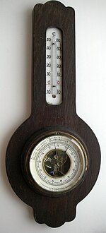
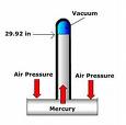
1. Barometer: This is an instrument that is used to measure atmospheric pressure. It can also be referred to as Torriceli's Tube, that is the Torriceli invented this instrument
2. Wind vane/weather vane/weather coak: It is an instrument for showing the direction of wind.
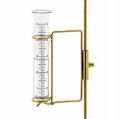
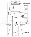
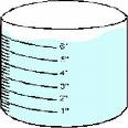
3. Rain gauge/Udometer/Pluviometer/Fluviograph: Is the instrument used to measure the amount of liquid precipitation over a set period of time.
4. Snow gauge: This does almost the same job as the Rain gauge but unlike the rain gauge, the snow gauge measures Solid precipitation
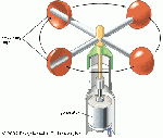
5. Anemometer: An anemometer is a device used to measure wind speed. It helps us know how fast wind is moving at a given time.
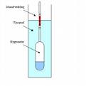
6. Hydrometer: It is the instrument used to measure the relative density or the specific gravity of liquids i.e. the ratio of the density of liquid to the ratio of the water density.
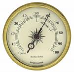
7. Hygrometer: It is an instrument used to measure the relative humidity.
8. Thermometer: It is an instrument used for measuring temperature.
9. Seismograph: An instrument used to measure ground movement caused by earthquake or explosions.
The Weather station
A Weather station is a place where weather instruments are kept and used for measuring and recording the elements of weather. A similar facility which is bigger and more advanced is known referred to as a Meteorological station. A weather station is normally established in an open area free from any form of obstruction. A major structure in a weather station is a Stevenson screen. The other instruments in a weather station include a rain gauge, wind vane, anemometer, evaporimeter, windsock, sunshine recorder etc.
Stevenson screen:
This is a specially designed box – like structure on stands in which some instruments for recording weather are kept. A Stevenson screen has a number of characteristics or features.
Important Features of a Stevenson Screen:
- It is made up of wood: i.e. to prevent absorption and conduction of heat.
- Panted white or silver grey;- In order to reflect sunshine.
- Stands are 1 metre high:- to avoid the influence of ground conditions.
- The sides and floor are made of louvers or slats to allow free circulation of air and to keep off direct sun rays.
- It has an insulated roof to create a bad conductor of heat. This is done by creating an air space between the layers of the roof.
- The roof is slanting to avoid the accumulation and stagnation of rain water.
- It stands on grass covered ground.
- It is fixed or placed far from buildings or obstacles to avoid any interference.
Importance of measuring and recording Weather
- Helps in discribing the climate of a place;wether it is equatorial climate or tropical climate among other climatic types.
- Helps farmers to plan when to plant their crops and when to harvest them.
- Iportant in the aviation industry, in that it helps pilots to know when to take off and when to land.
- Helps sailors at sea to timetable their journeys.
- Helps farmers to plan when to plant and when to harvest their crops.
- Helps people to plan what to put on or dress for the day for example they will know wether or not to put on a sweater or jacket and wether or no to carry an umbrella.
- Helps the government to prepare for disasters like floods, drought, very strong winds among others.
Factors influencing Weather and Climate
- Relief: - Highlands or mountains lead to the formation of relief rainfall on the windward side and dry conditions on the lee ward side.
- Altitude: - Highlands experience lower temperatures than low lands. The higher one goes the cooler it becomes.
- Latitude: - The tropical areas i.e. areas of low latitude experience higher temperatures and rainfall. Areas of higher latitude e.g. the temperate and Polar Regions experience lower temperatures.
- Water Bodies: - Nearness to a large water body influences the climate of the area. Water bodies are sources of atmospheric moisture through evaporation and areas near them experience higher rainfall.
- Natural Vegetation:- Forested and wetland areas contribute to the atmospheric vapour though transpiration leading to the formation of rainfall. Areas without vegetation or limited vegetation experience less rainfall.
- Prevailing Winds: - Moist prevailing winds bring in rainfall unlike dry winds. Winds also help in the distribution of temperatures i.e. warm winds bring in warm conditions while cold winds bring in cool conditions.
- Ocean Currents: - These are moving ocean waters. They may be cold or warm i.e. cold and warm ocean currents. Warm ocean currents lead to the formation of high rainfall on the adjacent coastal areas. Cold ocean currents lead to low rainfall and formation of marine deserts in the adjacent coastal areas e.g. the Namib desert.
- Man’s Activities: - Activities like deforestation, swamp reclamation, industrialisation, etc. lead to semi arid and arid conditions through the process of desertification. In addition environmentally unfriendly human activities lead to global warming.
| What is the weather now?
What was the weather earlier on? What is the weather likely to be later on? |
In summary we have been able to cover the following:
|

