File:Screen Shot 2013-10-29 at 8.08.35 PM.png
From WikiEducator
Size of this preview: 800 × 557 pixels. Other resolution: 1,029 × 716 pixels.
Original file (1,029 × 716 pixels, file size: 195 KB, MIME type: image/png)
Summary
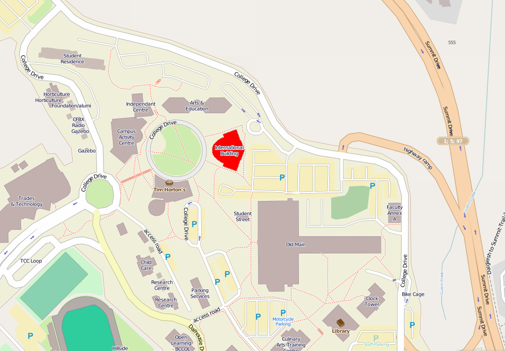
| Description | The International Building is to the right of the main circle in the center of the map. |
|---|---|
| Source | http://www.openstreetmap.org/#map=17/50.67220/-120.36398 |
| Date | 2013 |
| Author | Open Street Map contributors |
| Permission | See below. |
Open Street Map copyright policy: http://www.openstreetmap.org/copyright
Licensing:
| Licensed under the Creative Commons Attribution-Share Alike 3.0 Unported license, allowing you the freedom to reuse provided proper attribution is maintained and the requirement to distribute any modifications under the same, similar, or compatible terms. |
File history
Click on a date/time to view the file as it appeared at that time.
| Date/Time | Thumbnail | Dimensions | User | Comment | |
|---|---|---|---|---|---|
| current | 15:16, 30 October 2013 | | 1,029 × 716 (195 KB) | Peteforsyth (Talk | contribs) | highlight IB bldg |
| 15:11, 30 October 2013 |  | 1,029 × 716 (311 KB) | Peteforsyth (Talk | contribs) | {{Information |Description=The International Building is to the right of the main circle in the center of the map. |Source=http://www.openstreetmap.org/#map=17/50.67220/-120.36398 |Author=Open Street Map contributors |Date=2013 |Permission= |other_version |
- You cannot overwrite this file.
File usage
The following page links to this file: